The hike from Waterfall Gully to Mount Lofty Summit is Adelaide’s most iconic bushwalk—a challenging trail that rewards determined hikers with spectacular panoramic views stretching from the Adelaide Plains to Gulf St Vincent. At 727 metres above sea level, Mount Lofty is the highest point in the Mount Lofty Ranges and draws over 600,000 visitors annually. Whether you’re a fitness enthusiast seeking a regular workout or a visitor looking for Adelaide’s best natural viewpoint, this comprehensive guide covers everything you need for a safe, enjoyable hike.
Trail Overview: Waterfall Gully to Mount Lofty Summit
The main route from Waterfall Gully to Mount Lofty Summit is a well-established trail that follows a creek valley before ascending steeply through native bushland to the summit. It’s classified as a Grade 4 (hard) hike by National Parks SA, meaning it requires reasonable fitness and appropriate preparation.
Key Statistics:
- Distance: 4.5 km one way (9 km return)
- Elevation gain: 450 metres
- Time: 2.5-3.5 hours return (depending on fitness)
- Difficulty: Hard/Challenging (Grade 4)
- Trail type: Out-and-back (same route both ways)
- Surface: Mix of formed path, rock steps, and natural trail
- Facilities: Toilets at trailhead and summit; cafe at summit
The trail begins at the Waterfall Gully car park (Waterfall Gully Road, Burnside) and ends at the Mount Lofty Summit lookout. Most hikers complete the return journey, though one-way options exist using public transport or a second car at the summit. This is one of the best things to do in Adelaide for active visitors.
The Trail in Detail: What to Expect
Section 1: Waterfall Gully to First Falls (800m, easy)
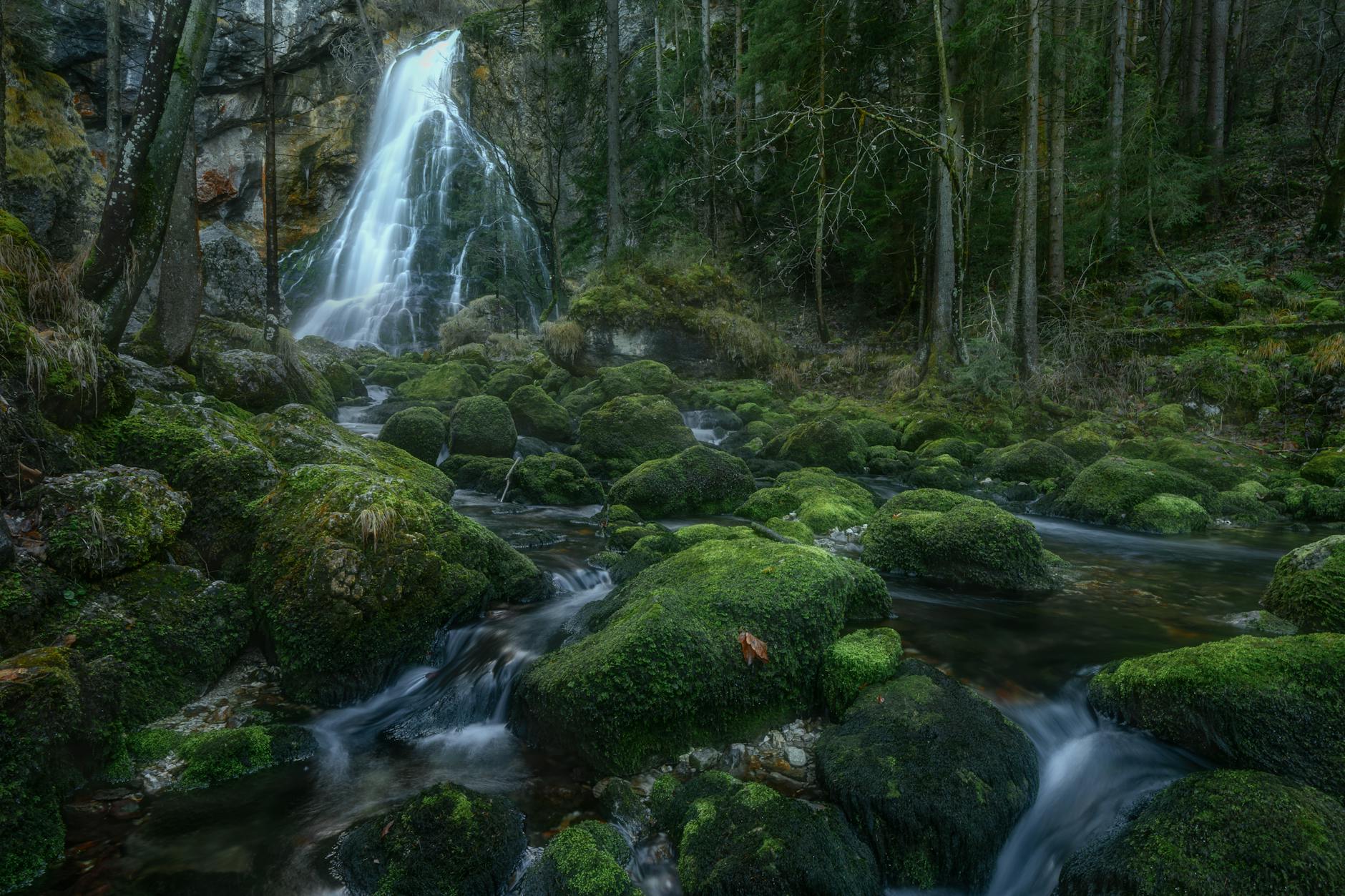
The trail begins gently along a wide, paved path following First Creek upstream. This accessible section passes through established gardens and native vegetation, with the sound of flowing water accompanying you. After approximately 800 metres, you reach First Falls—a beautiful waterfall that cascades over rock ledges into a pool below.
First Falls is spectacular after winter rains (June-September), when the creek runs at full volume. During dry months (December-March), the falls may be reduced to a trickle. Many walkers treat this as their destination—it’s a rewarding short walk suitable for all fitness levels and families with young children. Benches and a viewing platform provide rest spots.
Section 2: First Falls to Halfway Point (1.5km, moderate)
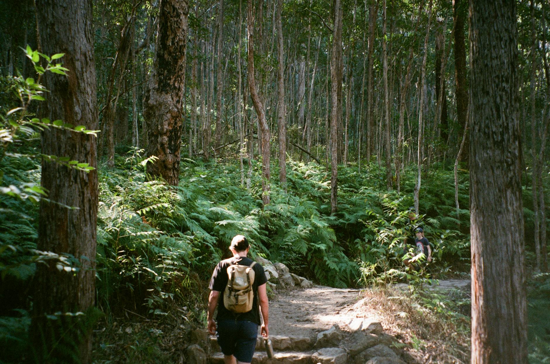
Beyond First Falls, the trail narrows and begins climbing in earnest. Stone steps (installed to prevent erosion) alternate with natural trail through dense eucalyptus forest. The gradient increases noticeably, and you’ll begin to feel the effort in your legs. Birdlife is abundant in this section—look for superb fairy-wrens, Adelaide rosellas, and kookaburras in the canopy.
The forest here is beautiful: grey box, brown stringybark, and South Australian blue gum create a dappled canopy overhead, while native grasses and ferns line the trail. In spring (September-November), wildflowers add splashes of colour. The trail crosses the creek several times via small bridges—these can be slippery when wet, so take care.
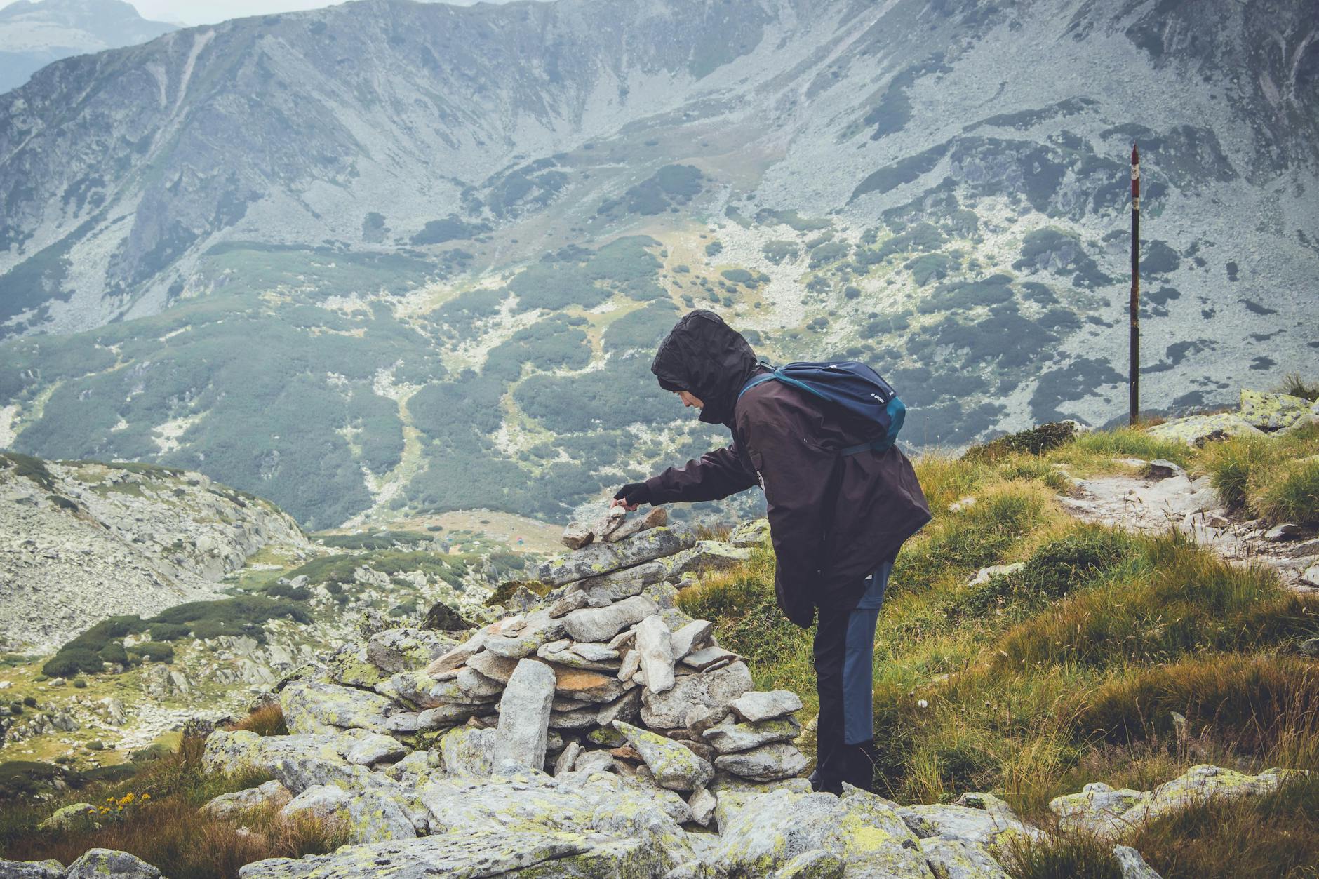
Section 3: Upper Trail to Summit (2.2km, hard)
The final section is the most demanding, with sustained steep climbing through increasingly open bushland. Long stone staircases test your legs, and the gradient rarely relents. On hot days, this exposed upper section can be brutally warm—there’s less canopy cover, and the sun reflects off rock surfaces.
As you climb higher, glimpses of the Adelaide skyline begin appearing through gaps in the trees—motivation to keep pushing. The final 500 metres follows a boardwalk and formed path to the summit lookout platform. The sense of achievement upon reaching the top is genuine—you’ve earned the view.
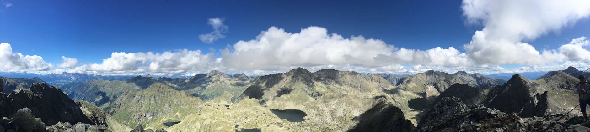
Mount Lofty Summit: The Reward
At 727 metres above sea level, Mount Lofty Summit offers Adelaide’s most spectacular panoramic viewpoint. On clear days, you can see the entire Adelaide Metropolitan area spread below, the Gulf St Vincent coastline stretching to the horizon, and—on exceptionally clear days—Kangaroo Island some 100 kilometres to the south.
The summit complex includes:
- Summit Lookout: A large viewing platform with 360-degree views. Information boards identify landmarks visible from the summit. Sunrise and sunset are particularly spectacular.
- Summit Cafe: A welcome sight after the climb, serving coffee, light meals, and cold drinks. Quality is surprisingly good for a summit cafe—their toasties and cakes hit perfectly after the exertion. Open daily.
- Gift shop: Souvenirs, maps, and basic supplies.
- Toilets: Clean facilities available during opening hours.
- Information centre: Staffed by knowledgeable volunteers who can answer questions about the area.
Many hikers spend 30-60 minutes at the summit, resting, photographing, and enjoying refreshments before the descent. The return journey is faster (largely downhill) but harder on the knees—trekking poles help significantly if you have them.
When to Hike: Seasonal Guide
Autumn (March-May): Ideal Conditions
Autumn offers the best all-round hiking conditions: comfortable temperatures (15-22°C at the base, 10-15°C at summit), reduced fire risk, and beautiful golden light. Mornings are crisp and clear, and the trail is less crowded than summer. This is the best time to visit for hiking in the Adelaide Hills.
Winter (June-August): Waterfalls and Atmosphere
Winter brings the waterfalls to life—First Falls and the numerous smaller cascades along the route flow dramatically after rainfall. Temperatures are cool (8-14°C base, 2-8°C summit), and cloud can obscure summit views. The trail can be muddy and slippery after rain. Dress in layers and bring waterproof gear. Despite the challenges, winter hiking has a moody beauty—mist drifting through eucalyptus, empty trails, and a genuine sense of wilderness just minutes from the city.
Spring (September-November): Wildflowers
Spring is beautiful on the trail: wildflowers bloom along the path, bird activity peaks with nesting season, and temperatures are mild (14-20°C). September can still be wet and muddy, but by October conditions are generally excellent. Creek flow remains strong from winter rains.
Summer (December-February): Early Starts Essential
Summer hiking requires careful planning. Temperatures can exceed 40°C on extreme days (30-35°C is common), and the exposed upper sections offer minimal shade. Start before 7am to complete the hike before peak heat. Carry extra water (2+ litres per person). The trail may close on Total Fire Ban days—check the CFS website before departing. Despite the heat, dawn hikes in summer offer magical light and the city spread below in golden haze.
Essential Preparation and What to Bring
Water: Minimum 1.5 litres per person (2+ litres in warm weather). There’s no reliable water source on the trail beyond the trailhead. The summit cafe sells drinks, but don’t rely on this alone—bring enough to complete the hike if the cafe is closed.
Footwear: Sturdy shoes with ankle support and good grip are essential. The stone steps and natural rock surfaces can be slippery, especially when wet. Trail runners are fine for fit, experienced hikers in dry conditions; hiking boots are recommended for most people.
Sun protection: Hat, sunscreen (SPF 50+), and sunglasses. The upper trail has limited shade, and UV levels in South Australia are extreme, particularly from October to March.
Layers: The summit can be 8-10°C cooler than the base. Even on warm days, bring a light layer for the top—wind chill at 727 metres is significant. In winter, a warm fleece and windproof jacket are essential.
Food: Energy snacks for the trail (nuts, fruit, muesli bars). A picnic at the summit is a lovely reward for the effort.
Phone: Charged and with you for emergencies. Mobile reception is generally good throughout the trail. Download offline maps as backup.
First aid basics: Bandaids, antiseptic wipes, and personal medications. Ankle rolls are the most common injury on this trail.
Parking and Access
Parking is the biggest practical challenge for this hike, particularly on weekends. The Waterfall Gully car park has limited spaces, and on popular mornings (especially Saturday and Sunday from 7-10am), it fills completely.
Tips for securing parking:
- Arrive before 7:30am on weekends (8am weekdays is usually fine)
- Avoid peak times: 8-10am Saturday and Sunday
- Overflow parking exists along Waterfall Gully Road, but adds distance to the walk
- Consider starting from an alternative trailhead (see below) on busy days
Public transport: Bus routes service Burnside Village and nearby stops, though you’ll need to walk 1-2km from the nearest bus stop to the trailhead. Check Adelaide Metro for current schedules. For broader information on getting around Adelaide, see our transport guide.
Dogs: Welcome on-leash throughout the trail. Bring water for your dog and bags for waste. The trail’s difficulty means it’s best suited to fit, experienced hiking dogs rather than small or elderly pets.

Alternative Routes to Mount Lofty Summit
If the Waterfall Gully trail is too crowded, too challenging, or you simply want variety, several alternative routes reach the summit.
Chambers Gully Loop (Moderate, 6km, 2-2.5 hours)
Starting from Chambers Gully car park (off Waterfall Gully Road), this loop trail offers a slightly less steep approach through beautiful remnant bushland. The gradient is more gradual, making it a good option for those who find the main trail too intense. You’ll still gain significant elevation, but the climb is spread more evenly across the distance. The loop means you don’t retrace your steps—always satisfying psychologically.
Crafers Approach (Easy-Moderate, 3km, 1-1.5 hours)
For those wanting summit views without the full challenge, the approach from Crafers (via Summit Road) offers a gentler alternative. The trail meanders through Cleland Conservation Park, gaining elevation gradually. It’s significantly easier than the Waterfall Gully route and suitable for moderate fitness levels. Parking is available at Cleland Wildlife Park.
Norton Summit Approach (Hard, 8km, 3-4 hours)
For experienced hikers seeking a longer adventure, the Norton Summit trail approaches from the north through less-visited bushland. This trail sees far fewer people and offers a genuine sense of wilderness. The distance and navigation requirements make it best suited to experienced bushwalkers with good map-reading skills.
Heysen Trail Connection
Mount Lofty Summit sits on the Heysen Trail—Australia’s longest dedicated walking trail (1,200km from Cape Jervis to the Flinders Ranges). Experienced hikers can incorporate the summit into multi-day sections of this trail for a more immersive Adelaide Hills experience.
Nearby Attractions: Making a Day of It

Cleland Wildlife Park
Just below the summit (accessible by car or a short walk), Cleland Wildlife Park offers close encounters with Australian animals in a natural bushland setting. Hand-feed kangaroos and wallabies, see koalas up close (including paid koala-hold experiences), and spot emus, wombats, echidnas, and native birds. The park occupies 35 hectares of native habitat, making it feel more like a conservation reserve than a traditional zoo.
Open daily 9:30am-5pm. Adult entry approximately $30. Allow 2-3 hours for a thorough visit. It’s an ideal activity to combine with a morning hike—descend from the summit to the park entrance rather than returning to Waterfall Gully. Perfect for families visiting Adelaide with kids.
Mount Lofty Botanic Garden
Located on the slopes below the summit, these cool-climate gardens showcase plants from temperate regions worldwide. Rhododendrons, magnolias, maples, and ferns thrive in the cooler, wetter conditions. Autumn (April-May) is spectacular as the deciduous trees turn golden. Free entry, open daily dawn to dusk.
Crafers and Stirling Villages
After your hike, the charming Adelaide Hills villages of Crafers and Stirling offer excellent cafes, boutique shopping, and a cool-climate atmosphere distinctly different from the Adelaide plains below. Stop for lunch at one of several quality restaurants that showcase Hills produce. These villages make excellent stops on an Adelaide Hills day trip.
Safety Considerations
While the Waterfall Gully trail is well-maintained and popular, it demands respect. The following safety points ensure an enjoyable experience.

Heat exhaustion: Adelaide’s summer heat can be dangerous. Symptoms include dizziness, nausea, rapid heartbeat, and confusion. If affected, stop immediately, rest in shade, and hydrate. Don’t attempt the hike on days forecast above 35°C unless starting very early.
Total Fire Ban days: The trail may close during Total Fire Ban conditions. Check the CFS (Country Fire Service) website or the park’s social media before departing. Closures are for your safety—bushfire in this terrain would be deadly.
Snakes: Eastern brown snakes and red-bellied black snakes are present in the area (more common October-March). Stay on formed trails, watch where you step, and give any snake you encounter a wide berth. Snakebite is extremely rare on this trail—snakes avoid humans when given the chance.
Slippery conditions: Stone steps and natural rock become very slippery when wet. Take particular care after rain and in winter. Trekking poles provide stability and reduce knee impact on the descent.
Know your limits: This is genuinely a hard hike. If you’re unsure of your fitness, start with the walk to First Falls (easy, 1.6km return) and assess how you feel before continuing. There’s no shame in turning back—the waterfall itself is a worthy destination.
Fitness and Training for the Trail
If you’re not regularly active, prepare for this hike with 2-3 weeks of training. Walk briskly for 45-60 minutes daily, incorporating hills where possible. Stair climbing (even using building stairwells) is excellent preparation for the stone steps you’ll encounter. Strengthening your quads and calves will make both the ascent and descent more manageable.
Regular hikers and fit individuals will find the trail challenging but achievable without specific preparation. Marathon runners and cyclists often use it as a training route—you’ll see plenty of fitness enthusiasts powering up the trail on weekday mornings.

Photography Tips for Mount Lofty
Mount Lofty offers outstanding photography opportunities throughout the day and seasons. For summit panoramas, golden hour (sunrise or the hour before sunset) provides the most dramatic light, with the city and Gulf St Vincent bathed in warm tones. Winter mornings sometimes produce temperature inversions that fill the valley with fog—the city peeking through clouds from above is extraordinary.
Along the trail, look for morning light filtering through eucalyptus canopy, water flowing over rock at the falls, and native wildlife. A telephoto lens (or phone zoom) helps capture birds in the canopy. Macro photography of wildflowers rewards patience in spring.
Combining Mount Lofty with Other Adelaide Experiences
Mount Lofty works beautifully as part of a broader Adelaide day trip. Morning hike followed by Cleland Wildlife Park makes a full morning. Add lunch in Stirling or Crafers, then explore the Adelaide Hills’ wineries, gardens, or wine regions in the afternoon.
For visitors spending multiple days in Adelaide, dedicate one morning to this hike. It provides context for the city’s geography—seeing Adelaide from above helps you understand the layout and plan other activities. The beaches and nature attractions visible from the summit become more enticing once you’ve appreciated the distance between the hills and the coast.
Whether you tackle the full summit challenge or simply enjoy the gentle walk to First Falls, the Mount Lofty area represents Adelaide’s natural beauty at its finest—ancient bushland, dramatic views, and genuine wilderness just 15 minutes from the CBD. It’s one of those rare experiences that both tourists and locals treasure equally. Plan your broader Adelaide trip around an early-morning summit attempt, and you’ll start the day with a sense of achievement that colours everything that follows.

Alternative Routes and Extended Walks
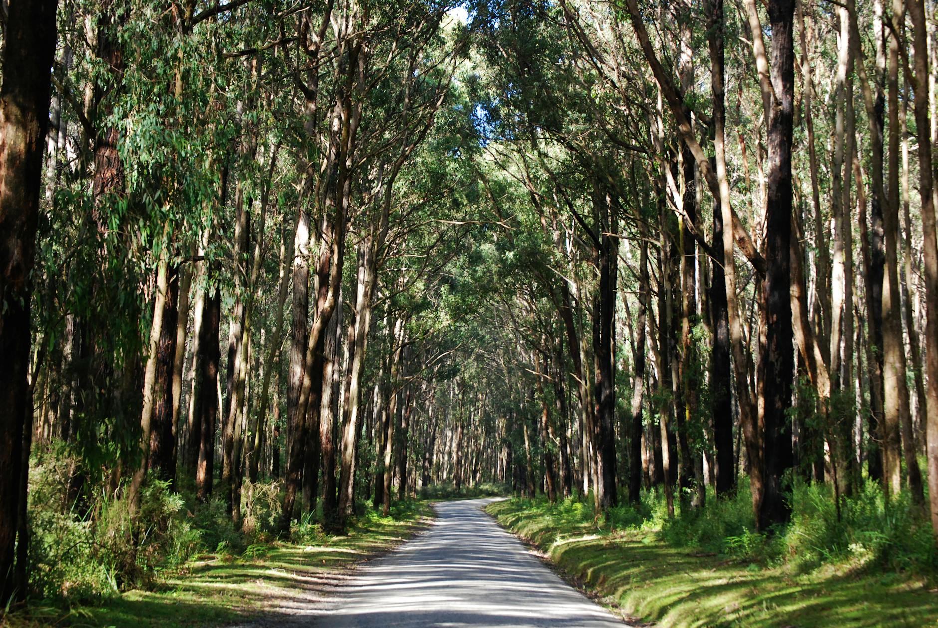
While the Waterfall Gully to Mt Lofty Summit trail remains the most popular route, experienced hikers and those seeking variety will find numerous alternative approaches that offer different perspectives on this iconic landscape. The Chambers Gully approach provides a gentler gradient that makes the summit accessible to a wider range of fitness levels, winding through eucalyptus forest along a creek bed before connecting with the main trail network near the summit ridge. This route is particularly pleasant in autumn when the deciduous trees planted by early settlers create splashes of gold and amber against the evergreen bush.
The Norton Summit Road access point opens up a network of trails along the eastern face of the ranges, offering completely different vegetation communities and views across the Adelaide Hills hinterland. From here, walkers can follow well-marked paths through stringybark forests and open grasslands before joining the summit trail from the north. The Crafers trail approach begins from the freeway-adjacent car park and follows a series of fire tracks and single-track paths that are popular with trail runners seeking a longer workout with varied terrain. This route passes through some of the most pristine bushland in the Adelaide Hills and offers excellent birdwatching opportunities.
For those interested in Mt Lofty hiking as part of a longer adventure, the connections to the Heysen Trail open up extraordinary possibilities. This world-class long-distance path passes directly through the summit area, meaning day walkers can follow sections of the Heysen either north toward Norton Summit or south toward Mylor and beyond. These extended sections transform a simple summit walk into a genuine bushwalking experience, with opportunities to observe wildlife, discover hidden waterfalls, and experience the solitude that only distance from trailheads provides.
The Pioneer Women’s Trail offers a popular loop option that commemorates the contributions of women to South Australia’s early colonial settlement. This well-maintained circuit passes interpretive signs and memorial markers while providing excellent views across the Adelaide Plains. The trail’s moderate difficulty and interesting historical content make it an ideal option for families or those seeking a less strenuous alternative to the direct summit assault. Combined with the summit track, it creates a satisfying half-day circuit that offers variety in terrain and scenery.
Monthly moonlight walks have become a beloved Mt Lofty hiking tradition, with groups gathering on full moon evenings to experience the mountain in an entirely different light. The nocturnal atmosphere transforms familiar trails into mysterious landscapes, with the city lights below creating a glittering carpet that extends to the coast. These events, organised through local bushwalking clubs and community groups, provide a safe and social way to experience night hiking, with experienced leaders guiding participants along the main trail by torchlight and moonshine.
Trail runners have increasingly discovered Mount Lofty as an outstanding training ground, with the steep gradient and technical terrain providing excellent preparation for ultra-marathon events. Popular training routes combine the Waterfall Gully ascent with extended ridge running and multiple summit repetitions. Early morning runners often complete two or three ascents before work, taking advantage of the well-lit dawn hours and relatively cool temperatures. The trail running community has grown substantially, with informal groups meeting regularly at the Waterfall Gully car park for group sessions that welcome all abilities and provide tips on foot placement, pacing strategies, and hydration planning for hot weather running.
Leave a Reply