Drive south from Adelaide for forty minutes and the suburbs simply run out. The Southern Expressway drops you into vineyards, the vineyards roll down to cliffs above Gulf St Vincent, and an hour or so later you are on a quiet road above a cove so clear you can see the weed on the bottom from the car park. The Fleurieu Peninsula is Adelaide’s backyard: wine country, two very different coastlines, a national park at the tip and the ferry to Kangaroo Island, all close enough to do in a day and good enough to deserve three.
This guide takes the whole peninsula region by region: how to get there and around, the McLaren Vale wine coast, the beaches on each side, Second Valley and Cape Jervis, Deep Creek, the Victor Harbor and Goolwa coast, the quieter wine regions, a coastal drive loop, whale season, where to base yourself and when to go. Prices and opening details were checked in November 2026 against operators’ own sites, National Parks and Wildlife Service South Australia, the Bureau of Meteorology and the regional tourism body; treat them as the right order of magnitude and check before you travel.
The Fleurieu Peninsula at a Glance
| What | The short answer |
|---|---|
| Where | The peninsula south of Adelaide, between Gulf St Vincent and the Southern Ocean |
| Drive from Adelaide | 45 minutes to about 1 hour 30, depending on where you are going |
| Main towns | McLaren Vale, Willunga, Normanville, Victor Harbor, Port Elliot, Goolwa |
| Public transport | Trains to Seaford, then limited buses and LinkSA coaches; a car is far easier |
| Wine regions | McLaren Vale, Langhorne Creek, Currency Creek, Southern Fleurieu |
| Deep Creek National Park | A$14.40 per vehicle; some areas closed for bushfire recovery |
| Whale season | Roughly June to October on the south coast |
| Kangaroo Island ferry | SeaLink from Cape Jervis, about 45 minutes to Penneshaw |
| Time to allow | A day for one corner; two or three nights for the loop |
A Quick Orientation
The peninsula takes its name from Charles Pierre Claret de Fleurieu, the French navigator and minister after whom Nicolas Baudin named it in 1802. It is easiest to think of it as four parts. The north is wine country, centred on McLaren Vale and Willunga, barely beyond Adelaide’s southern suburbs. The west coast faces Gulf St Vincent: calm water, long sandy beaches and small coves, running down past Normanville and Second Valley to Cape Jervis. The tip is rugged and wild, with Deep Creek National Park and the ferry terminal. And the south coast faces the open Southern Ocean, with surf beaches, whales in winter and the holiday towns of Victor Harbor, Port Elliot and Goolwa, where the Murray reaches the sea.
The two coasts feel completely different. The gulf side has flat water, sunset views and family swimming; the ocean side has swell, wind and drama. Most visitors pick one, which is a pity, because the drive between them over the hills is half the fun.
Getting There and Getting Around
By car
Driving is by far the easiest way to see the Fleurieu. The regional tourism body directs drivers onto the Southern Expressway out of Adelaide, and from there McLaren Vale is under an hour, while the further corners take up to about an hour and a half. Victor Harbor is 84km from Adelaide. Roads are sealed to all the main towns, though some beach and park access roads are gravel. If you are hiring, our car rental guide covers the options.
By public transport
It is possible, but slow and patchy. Adelaide Metro trains run as far south as Seaford, and Adelaide Metro buses reach McLaren Vale, Willunga, Aldinga and Strathalbyn. Beyond that, LinkSA runs coaches from Adelaide to Mount Compass, Port Elliot, Middleton, Goolwa and Victor Harbor, and its route 1259 runs to Cape Jervis. The Cape Jervis service is a public route that needs no booking, does not carry bikes and does not run on Christmas Day, and it is separate from the SeaLink ferry coach. Check linksa.com.au and adelaidemetro.com.au for current times and fares.
The honest verdict: public transport works for a day in Victor Harbor or a trip to the ferry, but not for the peninsula itself. The beaches, cellar doors and lookouts that make the Fleurieu worth visiting are spread out, and the buses do not go to them.
On a tour
Day tours from Adelaide mostly focus on McLaren Vale wineries, sometimes with a stop at the coast. They suit anyone who wants to taste wine without worrying about driving. Our wine tours guide compares them.
McLaren Vale and Willunga: The Wine Coast
McLaren Vale is the Fleurieu’s best-known name and the closest part to Adelaide; d’Arenberg describes it as 45 minutes south of the city. It is a Mediterranean-feeling patchwork of vineyards, olive groves and almond trees running from the hills down towards the sea, famous above all for shiraz and grenache.
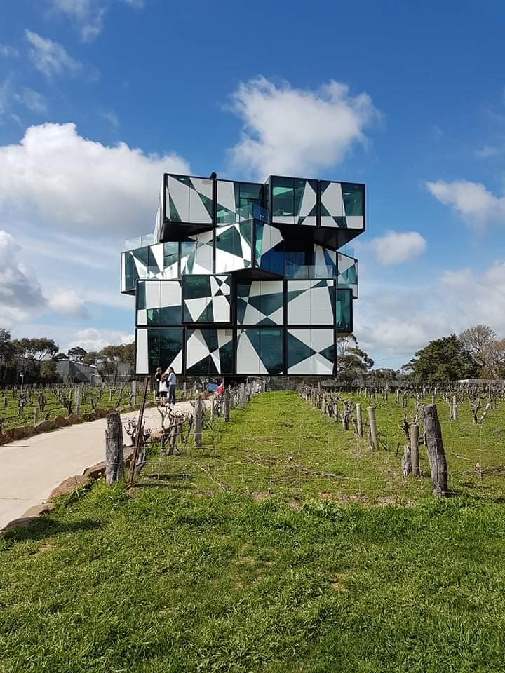
The headline attraction is the d’Arenberg Cube, a five-level glass building among the vines on Osborn Road, open daily from 10:30am to 4:30pm. General admission is A$20 for adults and A$10 for under-18s, and includes the Alternate Realities Museum and a wine tasting. It is touristy, yes, but it is also genuinely fun, and the view from the top-floor tasting room over the vineyards, the Willunga Hills and the gulf is worth the ticket on its own.
Willunga, just south, is the region’s old stone town and the home of the Willunga Farmers Market, which runs every Saturday from 8am to noon at Willunga High School. Get there early: by late morning the best produce and the coffee queue are both at their worst. Two trails link the area for walkers and cyclists: the Shiraz Trail runs 8km one way between McLaren Vale and Willunga on mostly flat ground, past cellar doors, and the Coast to Vines Rail Trail runs 35km from Marino down to Willunga.
For which cellar doors to visit, see our McLaren Vale wine guide and the McLaren Vale day trip. If you are choosing between the two big wine regions, Barossa vs McLaren Vale helps, and the Fleurieu’s real advantage is simple: the beach is ten minutes away.
The Gulf Beaches: Port Willunga to Sellicks
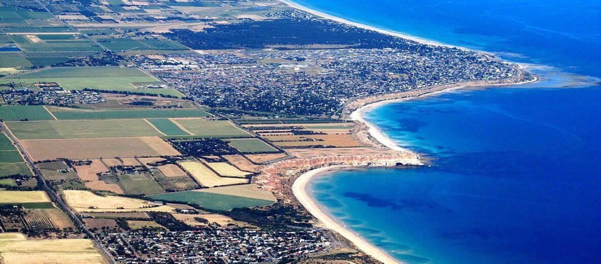
Below McLaren Vale, the gulf coast is one long run of sand and cliffs, and these are the beaches Adelaide locals drive to on hot weekends.
- Port Willunga: about 35km south of Adelaide, with golden cliffs, soft white sand and the stumps of an old jetty. The jetty was working by 1853, shipping cargo such as slate and flour, and was judged beyond repair in 1915. The Star of Greece restaurant sits on the clifftop above. It is one of the loveliest sunset spots on the coast.
- Maslin Beach: high cliffs above a long beach, good for picnics and sunsets.
- Aldinga: long, flat and family-friendly. The Aldinga Reef Aquatic Reserve, a sanctuary zone in the Encounter Marine Park, is a good snorkelling spot at low tide.
- Moana: a long, wide beach popular for surfing, swimming, snorkelling, fishing and coastal walks.
Some of these beaches allow cars on the sand in set areas, which surprises visitors. The rules, permits, speed limits and seasonal closures belong to the City of Onkaparinga, so check its cars-on-beaches page before you drive onto one, and watch for children and sunbathers if you do. For a ranked list of the best swimming beaches around the city, see our best beaches near Adelaide.
The West Coast: Normanville to Cape Jervis
South of Sellicks Hill the road climbs over the range and drops into a quieter, more rural stretch of coast. Normanville is the main town here, with a long sandy beach, and the little town of Yankalilla sits just inland. This side of the peninsula is covered by Tourist Drive 52, the Hills and Seascapes Discovery Drive, an 85km signed route through the hills and along the western coast.
Second Valley
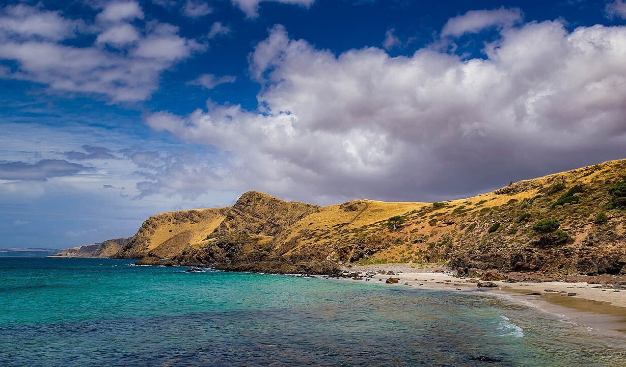
Second Valley is the jewel of the west coast: a small, sheltered cove with a jetty, cliffs on both sides and clear water. It is a good place to swim, snorkel, dive or fish, there are picnic areas and toilets, and it is about 90 minutes from Adelaide. Come on a calm morning, walk out to the point, and you will understand why people drive this far for one small beach.
Rapid Bay
Rapid Bay is known among divers for its jetties. A 20m exclusion zone around the old jetty bans divers, swimmers and vessels, so check the Department for Infrastructure and Transport’s Rapid Bay page for its current status before you plan a dive here.
Cape Jervis
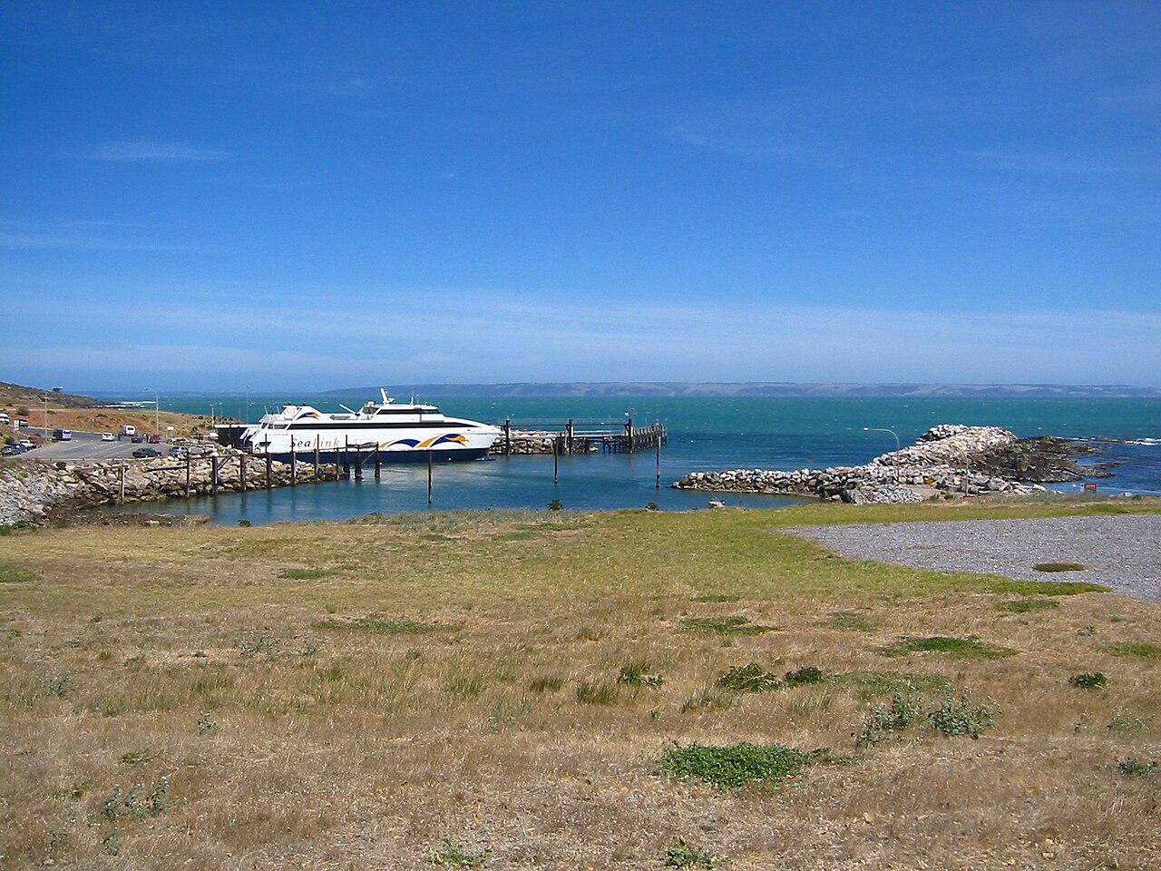
Cape Jervis, at the tip, is mainly about the SeaLink ferry: the crossing to Penneshaw on Kangaroo Island takes about 45 minutes. It is also the southern end of the Heysen Trail, which runs 1,200km north to Parachilna Gorge in the Flinders Ranges. There is not much in Cape Jervis itself, so time your arrival for the boat. Our guide to Kangaroo Island from Adelaide covers the ferry, fares and whether to take the car across.
Deep Creek National Park
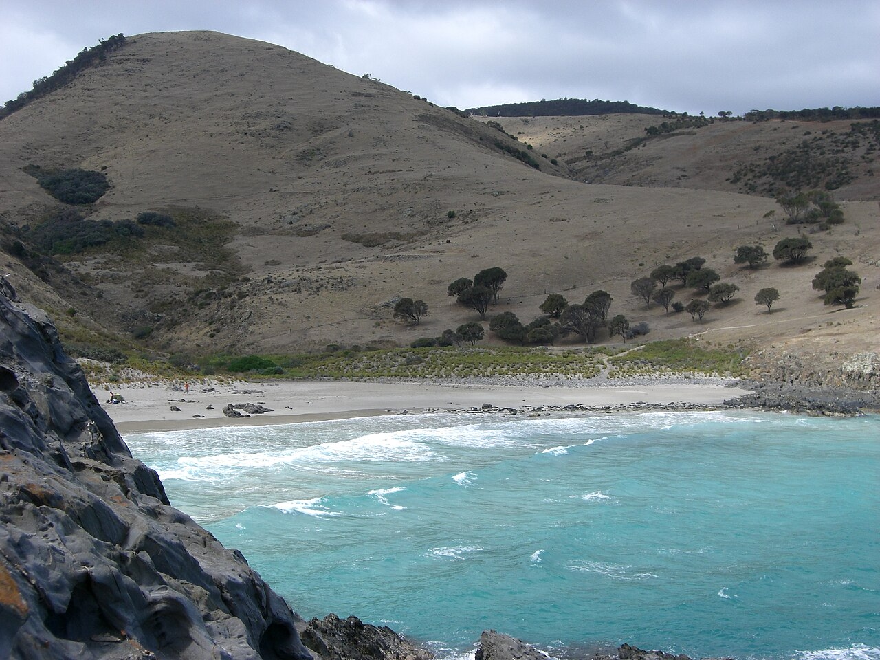
The southern tip of the peninsula is its wildest corner. Deep Creek National Park, about 105km from Adelaide, is steep, scrubby and beautiful, with valleys running down to an exposed, rocky coast. Western grey kangaroos graze the clearings in the evenings, and the park is home to short-beaked echidnas and around 100 bird species.
- Entry: A$14.40 per vehicle; camping and accommodation from A$27.50 a night, booked and paid for before you arrive.
- Bushfire recovery: an early-2026 bushfire burned about 40 percent of the park. Parts remain closed for recovery until further notice, so check the National Parks SA page before you set off, and expect some tracks to be shut.
- Walks: the Blowhole Beach Hike is 3km and about 2.5 hours, Grade 4. The Deep Creek Circuit is a serious Grade 5 day: 11km and around 7 hours, with steep terrain and rock scrambling.
- Fire danger: the park closes on Catastrophic fire danger days and may close on Extreme days. Wood and solid-fuel fires are banned from 1 December 2026 to 24 March 2027.
- Phones: mobile coverage is patchy, especially in the valleys.
Blowhole Beach is the classic Deep Creek walk: a steep descent to a wild beach between headlands, and a steep climb back. It is rough, not a swimming beach, and very much worth the effort. For more trails around the region, see hiking trails near Adelaide and our overview of national parks near Adelaide.
The South Coast: Victor Harbor, Port Elliot and Goolwa
Between Deep Creek and Victor Harbor, Waitpinga and Parsons beaches are wild Southern Ocean surf beaches, spectacular to look at and dangerous to swim at because of strong rips. Admire them from the sand, and swim only at patrolled beaches between the flags. For surf conditions and safety, check Beachsafe and Surf Life Saving SA.
Victor Harbor
Victor Harbor is the main town on the south coast, on Encounter Bay, and the one most visitors know. The main thing to do is cross to Granite Island: walk the 630m causeway or ride the horse-drawn tram pulled by Clydesdales, which costs A$30 return for adults and A$25 for children aged 4 to 13. Entry to Granite Island Recreation Park is free, and the Kaiki Walk loops 2.9km around it in about an hour. Granite Island’s penguin tours are not running because penguin numbers are very low.
Back on the mainland, The Bluff (Rosetta Head) has a 600m summit loop from the car park to a 97m-high lookout, and the South Australian Whale Centre charges A$5 for adults. In whale season, Big Duck Boat Tours’ 90-minute whale-watching trips cost A$85 for adults and A$65 for children aged 2 to 15, though sightings are not guaranteed. Our Victor Harbor and Granite Island guide has the full picture.
Port Elliot
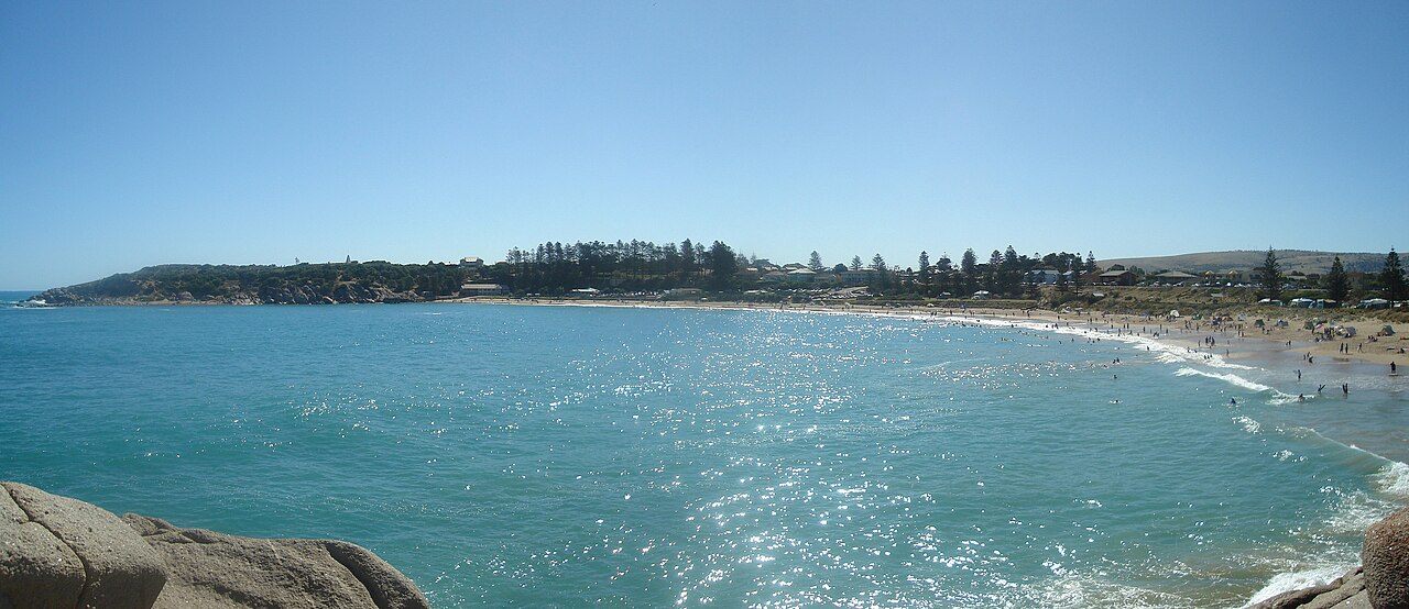
Port Elliot, a few minutes east, is one of the prettiest towns on the coast and our pick as a base. Its main draw is Horseshoe Bay, a curve of sand protected by granite headlands, with the Flying Fish Café right on the beachfront. It is far more sheltered than the open surf beaches along this coast.
Middleton and Goolwa
Middleton sits on the Encounter Bikeway between Port Elliot and Goolwa. Goolwa sits near the mouth of the Murray, where Australia’s longest river meets the sea, and is the departure point for cruises into the Coorong, such as Spirit of the Coorong’s seasonal full-day trip with guided walks and lunch on board. Our guide to Goolwa and the Murray Mouth covers it in detail.
The Cockle Train and the Encounter Bikeway
Two ways to link the south coast towns without the car:
- The Cockle Train: a heritage railway between Goolwa and Victor Harbor via Port Elliot, on the line of the original railway that linked the River Murray at Goolwa with Port Elliot in 1854. Regular services run on Wednesdays, Saturdays and Sundays, with extras in South Australian school holidays, on long weekends and at Easter. It usually runs heritage railcars rather than steam, so do not book expecting a steam engine.
- The Encounter Bikeway: 30km one way between Victor Harbor and Goolwa via Port Elliot and Middleton, mixing on-road sections and shared trail. It is mostly easy riding and the best way to see the coast slowly.
Wine Beyond McLaren Vale
The Fleurieu wine zone covers five regions: McLaren Vale, Langhorne Creek, Currency Creek, Southern Fleurieu and Kangaroo Island. The four on the mainland are below. Most visitors only see McLaren Vale, which is a shame.
| Region | Where | Why go |
|---|---|---|
| McLaren Vale | The north of the peninsula, 45 minutes from the city | Shiraz and grenache, big-name cellar doors, the Cube |
| Langhorne Creek | Inland, about 70km from Adelaide | A wine region since the 1850s, on the floodplain of the Bremer and Angas rivers; quieter, friendly, good value |
| Currency Creek | Inland from Goolwa | Small and low-key; easy to add to a south coast day |
| Southern Fleurieu | The hills between the two coasts | A scattering of small producers in the hills |
Langhorne Creek in particular rewards a detour on the way home from Goolwa. Our guide to Langhorne Creek and Coonawarra covers its cellar doors.
A Fleurieu Coastal Drive Loop
There is no single official “Fleurieu drive”, but this loop takes in both coasts and works over two or three days, or as a very long single day.
- Adelaide to McLaren Vale via the Southern Expressway. Cellar doors or the Cube in the morning.
- Willunga and Port Willunga for lunch near the cliffs.
- Over Sellicks Hill to Normanville and along Tourist Drive 52 to Second Valley for a swim.
- Cape Jervis and Deep Creek: the lookouts, a walk to Blowhole Beach, and kangaroos at dusk.
- Across the bottom of the peninsula to Victor Harbor, stopping at the Waitpinga lookouts.
- Port Elliot, Middleton and Goolwa, then home via Langhorne Creek or straight up through the hills.
Done in a day, this is too much: you will spend most of it in the car. Split it with a night at Second Valley or Normanville and a night at Port Elliot or Victor Harbor and it becomes one of the best short road trips in the state. Our South Australia road trips guide has more routes from Adelaide.
Whale Season
From roughly June to October, southern right whales come into Encounter Bay and along the south coast. They can reach 18m long and sometimes come within about 100m of the shore, which makes land-based watching realistic from Victor Harbor, The Bluff and the clifftops around Port Elliot and Deep Creek. Bring binoculars, be patient, and check recent sightings with the South Australian Whale Centre before you go.
Day Trip or Overnight?
A day trip works if you pick one corner. McLaren Vale and Port Willunga make an easy day; so do Victor Harbor and Port Elliot. Trying to do the whole peninsula in a day does not work: the drive from McLaren Vale to Second Valley to Deep Creek to Victor Harbor and back is a lot of hours behind the wheel, and you would see each place through a windscreen.
Two nights is ideal. Base yourself in McLaren Vale or Willunga for wine and the gulf beaches, or in Port Elliot or Victor Harbor for the south coast, whales and walks. Normanville and Second Valley suit people who want quiet and a swim. For a wider view of trips from the city, see our Adelaide day trips.
A two-day plan
Day 1: McLaren Vale in the morning, with the Cube or two cellar doors. Lunch near Willunga or Port Willunga, then over the hills to Second Valley for a swim. Continue to Deep Creek for the late afternoon and the kangaroos, and stay on the south coast.
Day 2: An early walk on Granite Island and The Bluff at Victor Harbor, morning coffee at Horseshoe Bay in Port Elliot, then the Cockle Train or the Encounter Bikeway to Goolwa. Head home via Langhorne Creek for a last tasting (with a designated driver).
When to Go
The Fleurieu is milder than Adelaide in summer, thanks to the sea breeze. The Bureau of Meteorology’s averages for its Victor Harbor (Encounter Bay) station, based on 2001–2026 records, show it clearly:
| Month | Mean max | Mean min |
|---|---|---|
| January | 25.2°C | 14.8°C |
| July | 15.5°C | 6.6°C |
| Year | 20.6°C | 10.3°C |
Annual rainfall at the station averages 549.4mm, with June the wettest month (83.4mm) and March the driest (19.2mm).
- Summer (December to February): beach season, with busy weekends and school holidays. Book accommodation early, and check fire danger ratings before visiting Deep Creek.
- Autumn (March to May): the dry, settled months and vintage in the wineries. Probably the best all-round time.
- Winter (June to August): cool, wet and windy, but this is whale season, and the cellar doors with fires are at their best.
- Spring (September to November): green hills, wildflowers and the last of the whales.
Frequently Asked Questions
How far is the Fleurieu Peninsula from Adelaide?
McLaren Vale is about 45 minutes south of the city, and the furthest corners are about an hour and a half away. Victor Harbor is 84km from Adelaide, and Deep Creek National Park is about 105km.
Can you do the Fleurieu Peninsula as a day trip?
Yes, if you choose one area, such as McLaren Vale and Port Willunga, or Victor Harbor and Port Elliot. The whole peninsula needs two or three days.
What are the best beaches on the Fleurieu Peninsula?
For swimming and snorkelling, Second Valley, Horseshoe Bay at Port Elliot and the gulf beaches from Port Willunga to Aldinga. For scenery, Blowhole Beach in Deep Creek and the Waitpinga and Parsons surf beaches, which have strong rips.
When is the best time to visit the Fleurieu?
Autumn is the best all-round season, summer is best for the beaches, and June to October is whale season on the south coast.
Can you drive on Aldinga Beach?
Cars are allowed on some sections of beach on this coast, under rules and permits set by the City of Onkaparinga. Check the council’s current rules, fees and closures before you drive onto the sand.
Is there public transport to the Fleurieu Peninsula?
Some. Adelaide Metro trains run to Seaford and buses reach McLaren Vale, Willunga and Aldinga, while LinkSA coaches serve Victor Harbor, Port Elliot, Goolwa and Cape Jervis. It is enough for a town visit but not for exploring.
Is Deep Creek National Park open?
The park is open, but parts are closed for bushfire recovery after an early-2026 fire. Check the National Parks SA page for current closures before you go.
If the ferry tempts you across from Cape Jervis, our Kangaroo Island itinerary plans three days on the island, from Cape Willoughby and Seal Bay to Remarkable Rocks.
Related Adelaide Guides
- McLaren Vale day trip from Adelaide
- McLaren Vale wine guide
- Victor Harbor and Granite Island
- Goolwa and the Murray Mouth
- Kangaroo Island from Adelaide
- Best beaches near Adelaide
- South Australia road trips
- Adelaide wine regions
Photo Credits
Second Valley cove: “Second Valley Beach (132902933).jpeg” by Shav Bird, via Wikimedia Commons, CC BY 3.0, cropped.
Horseshoe Bay, Port Elliot: “Horseshoe Bay panorama.jpg” by Jorcoga, via Wikimedia Commons, Public domain.
The SeaLink ferry at Cape Jervis: “Sea Link Ferry SA.JPG” by Cookaa, via Wikimedia Commons, CC BY-SA 3.0.
Aerial view of Maslin Beach, Port Willunga and Aldinga: “Aerial – Southern Beaches.jpg” by Orderinchaos, via Wikimedia Commons, CC BY-SA 3.0.